In a continuing discussion of utility locator technologies and applications in vacuum excavation, author Carol Brzozowski discusses ground-penetrating radar (GPR) in Part 6 of this ongoing series. Our author explains how a manufacturer surpasses conventional GPR limitations in the pursuit of higher sophistication in utilities location. Continue this series below, and learn why an experienced recognition of signature breaks is vital in GPR utility applications
Hitting the Hidden Mark (Part 6) By Carol Brzozowski
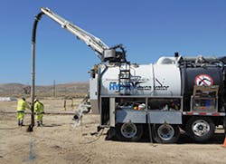
The combination of the vacuum and utility locator help get that precise target.
Mala GeoScience manufactures ground-penetrating radar (GPR) systems. The company developed the Mala Easy Locator HDR (high dynamic range)—the company’s latest product in this range, the Easy Locator Pro, was released in June 2014.
“We don’t even call it GPR,” says Matt Wolf, president.
The system features the industry’s highest bandwidth and resolution, Wolf says. “There’s a big push in the industry for the dual-frequency antennae, and that doubles the cost of the radar system. For the locators and contractors who don’t want to do a lot of sophisticated processes, we thought a single-frequency solution would always be the best.”
Older, conventional GPRs possess bandwidths in a certain range acceptable for many applications, “but typically you’d want to have two antennas, and that’s why the dual-frequency looked to be attractive. We developed a new way with the HDR technology to incorporate or record data at a much higher bandwidth that’s useful. Because of the increased bandwidth, you’re almost getting two for one in the antennae.”
Hitting the Hidden Mark (Part 6) By Carol Brzozowski
The combination of the vacuum and utility locator help get that precise target. Mala GeoScience manufactures ground-penetrating radar (GPR) systems. The company developed the Mala Easy Locator HDR (high dynamic range)—the company’s latest product in this range, the Easy Locator Pro, was released in June 2014. “We don’t even call it GPR,” says Matt Wolf, president. The system features the industry’s highest bandwidth and resolution, Wolf says. “There’s a big push in the industry for the dual-frequency antennae, and that doubles the cost of the radar system. For the locators and contractors who don’t want to do a lot of sophisticated processes, we thought a single-frequency solution would always be the best.” Older, conventional GPRs possess bandwidths in a certain range acceptable for many applications, “but typically you’d want to have two antennas, and that’s why the dual-frequency looked to be attractive. We developed a new way with the HDR technology to incorporate or record data at a much higher bandwidth that’s useful. Because of the increased bandwidth, you’re almost getting two for one in the antennae.” [text_ad] Soil can still present a challenge. “All GPR is subject to the negative effects of conductive material, soils like clay, and wet concrete,” says Wolf. “There are some soils that will never be conducive to radar, even with our HDR (technology). However, it does get increased penetration in the average soil by up to 20%. We’ve seen it against our own conventional equipment.” Nancy McMahon, a partner in Noalani’s Construction Consulting and Akamai Ground Penetrating Radar Services in Lihue, HI, uses Mala GeoSciences’ instruments in carrying out her underground locating work. The company uses GPR in construction and engineering projects, as well as in archaeology, historic preservation, geology, and environmental studies. For McMahon, her success in locating objects is a combination of using state-of-the-art technology and experience. An archaeologist by training, McMahon learned to read soil profiles with GPR when a USDA soil scientist brought that technology—as well as electromagnetic technology—to Hawaii in the 1990s. “I worked for the state at the time, and we took it to all of the islands to try it on different soil types and different locations where we knew I had archeological sites and deposits and see how it worked,” she says. Since then, many companies have adopted the technology. [text_ad] Because of her experience, McMahon says she can fine-tune her observations to know what is a PVC pipe or a clay pipe, “and metal is really easy to detect.” When the Mala unit came out (March 2013), McMahon practiced with it at the local mall where there are sewer problems and leaks. “I can pick up where a drainage was in the mall and where the excavations were for that and could clearly pick up in there that they have metal pipes—it was just ringing all over the place,” she says. “Clay pipes have a different signature and are harder to determine. I could see an excavation to the drainage, there was a storm line there, a sewer line, and then the water line was a little harder to detect.” That case might call for more excavation, McMahon says. “I could see where there’s something there, so if they were going to hit on anything, I could tell them what that would be,” she says. McMahon says it takes experience to be able to catch a signature or see there’s a break. “It reads soils in the breaks pretty well and the density as you’re hitting them. Do I know the depth of some of those things? I don’t know that I know it that well to tell that. There’s just something there. Water lines aren’t that deep, and I know sewers are really deep. It’s something that you have to keep proficient at and keep doing it. The more you keep doing it, the better your expertise is.” In the next part of this series—a continuation of utility locators and vacuum excavation applications—author Brzozowski specifically discusses cable-locating equipment.Soil can still present a challenge.
“All GPR is subject to the negative effects of conductive material, soils like clay, and wet concrete,” says Wolf. “There are some soils that will never be conducive to radar, even with our HDR (technology). However, it does get increased penetration in the average soil by up to 20%. We’ve seen it against our own conventional equipment.”
Nancy McMahon, a partner in Noalani’s Construction Consulting and Akamai Ground Penetrating Radar Services in Lihue, HI, uses Mala GeoSciences’ instruments in carrying out her underground locating work. The company uses GPR in construction and engineering projects, as well as in archaeology, historic preservation, geology, and environmental studies.
For McMahon, her success in locating objects is a combination of using state-of-the-art technology and experience. An archaeologist by training, McMahon learned to read soil profiles with GPR when a USDA soil scientist brought that technology—as well as electromagnetic technology—to Hawaii in the 1990s.
“I worked for the state at the time, and we took it to all of the islands to try it on different soil types and different locations where we knew I had archeological sites and deposits and see how it worked,” she says.
Since then, many companies have adopted the technology.
Hitting the Hidden Mark (Part 6) By Carol Brzozowski
The combination of the vacuum and utility locator help get that precise target. Mala GeoScience manufactures ground-penetrating radar (GPR) systems. The company developed the Mala Easy Locator HDR (high dynamic range)—the company’s latest product in this range, the Easy Locator Pro, was released in June 2014. “We don’t even call it GPR,” says Matt Wolf, president. The system features the industry’s highest bandwidth and resolution, Wolf says. “There’s a big push in the industry for the dual-frequency antennae, and that doubles the cost of the radar system. For the locators and contractors who don’t want to do a lot of sophisticated processes, we thought a single-frequency solution would always be the best.” Older, conventional GPRs possess bandwidths in a certain range acceptable for many applications, “but typically you’d want to have two antennas, and that’s why the dual-frequency looked to be attractive. We developed a new way with the HDR technology to incorporate or record data at a much higher bandwidth that’s useful. Because of the increased bandwidth, you’re almost getting two for one in the antennae.” [text_ad] Soil can still present a challenge. “All GPR is subject to the negative effects of conductive material, soils like clay, and wet concrete,” says Wolf. “There are some soils that will never be conducive to radar, even with our HDR (technology). However, it does get increased penetration in the average soil by up to 20%. We’ve seen it against our own conventional equipment.” Nancy McMahon, a partner in Noalani’s Construction Consulting and Akamai Ground Penetrating Radar Services in Lihue, HI, uses Mala GeoSciences’ instruments in carrying out her underground locating work. The company uses GPR in construction and engineering projects, as well as in archaeology, historic preservation, geology, and environmental studies. For McMahon, her success in locating objects is a combination of using state-of-the-art technology and experience. An archaeologist by training, McMahon learned to read soil profiles with GPR when a USDA soil scientist brought that technology—as well as electromagnetic technology—to Hawaii in the 1990s. “I worked for the state at the time, and we took it to all of the islands to try it on different soil types and different locations where we knew I had archeological sites and deposits and see how it worked,” she says. Since then, many companies have adopted the technology. [text_ad] Because of her experience, McMahon says she can fine-tune her observations to know what is a PVC pipe or a clay pipe, “and metal is really easy to detect.” When the Mala unit came out (March 2013), McMahon practiced with it at the local mall where there are sewer problems and leaks. “I can pick up where a drainage was in the mall and where the excavations were for that and could clearly pick up in there that they have metal pipes—it was just ringing all over the place,” she says. “Clay pipes have a different signature and are harder to determine. I could see an excavation to the drainage, there was a storm line there, a sewer line, and then the water line was a little harder to detect.” That case might call for more excavation, McMahon says. “I could see where there’s something there, so if they were going to hit on anything, I could tell them what that would be,” she says. McMahon says it takes experience to be able to catch a signature or see there’s a break. “It reads soils in the breaks pretty well and the density as you’re hitting them. Do I know the depth of some of those things? I don’t know that I know it that well to tell that. There’s just something there. Water lines aren’t that deep, and I know sewers are really deep. It’s something that you have to keep proficient at and keep doing it. The more you keep doing it, the better your expertise is.” In the next part of this series—a continuation of utility locators and vacuum excavation applications—author Brzozowski specifically discusses cable-locating equipment.Because of her experience, McMahon says she can fine-tune her observations to know what is a PVC pipe or a clay pipe, “and metal is really easy to detect.”
When the Mala unit came out (March 2013), McMahon practiced with it at the local mall where there are sewer problems and leaks. “I can pick up where a drainage was in the mall and where the excavations were for that and could clearly pick up in there that they have metal pipes—it was just ringing all over the place,” she says. “Clay pipes have a different signature and are harder to determine. I could see an excavation to the drainage, there was a storm line there, a sewer line, and then the water line was a little harder to detect.”
That case might call for more excavation, McMahon says. “I could see where there’s something there, so if they were going to hit on anything, I could tell them what that would be,” she says.
McMahon says it takes experience to be able to catch a signature or see there’s a break.
“It reads soils in the breaks pretty well and the density as you’re hitting them. Do I know the depth of some of those things? I don’t know that I know it that well to tell that. There’s just something there. Water lines aren’t that deep, and I know sewers are really deep. It’s something that you have to keep proficient at and keep doing it. The more you keep doing it, the better your expertise is.”
In the next part of this series—a continuation of utility locators and vacuum excavation applications—author Brzozowski specifically discusses cable-locating equipment.
