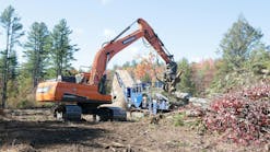
When Kokosing Construction Company Inc. of Fredericktown, OH, won the contract to build a new highway in Butler County, OH, just outside of Cincinnati, it knew it needed an accurate and efficient machine control system. The new Butler County Regional Highway consists of 10 mi. of road, one-fourth of which is concrete pavement and the other three-fourths asphalt divided highway. In addition to the size of the project, special concerns included raised entrance and exit ramps for the highway, often in circular, arced patterns, which typically prove difficult for grading.
Kokosing was given 24 months to complete the project, with the end date slated for June 2000. Spectra Precision’s (Dayton, OH) BladePro 3D, a laser- and radio communication-based machine control system, was one of the first systems Kokosing signed on for the project.
“BladePro 3D has been a great asset to our team,” says William Harper, surveyor for Kokosing. “We saw accurate results right away, especially in the areas of time and labor savings in the grading operations.” He estimates that Kokosing has been able to reduce the estimated duration of the project significantly, thanks in part to BladePro 3D, which has been used in every phase of the highway’s construction.
How It Works
BladePro 3D’s three-dimensional capability allows motorgrader operators to grade complex designs, such as vertical curves, transitions, super-elevated curves, and complex site designs, without stakes, stringlines, or layout. BladePro 3D also gives the operator a complete system with onboard design data for full automatic control of slope and elevation, making it ideal for the curves and slopes of the new highway.
The system employs a digital terrain model (DTM) from Spectra Precision’s TerraModel software. A data card inserted into the BladePro 3D graphical interface box allows the system to make use of site-plan data, eliminating the need for a fragile notebook computer setup on the job site.
BladePro 3D then uses a Geodimeter robotic total station to track and communicate the motorgrader’s position and blade elevation anywhere on the job site. Real-time position data are transmitted from the total station and compared to the DTM. If a correction is required, signals are automatically sent to the machine hydraulics to maintain the design elevation and cross slope.
“We’ve been able to use BladePro 3D for surveying and layout with minimal training involved,” states Harper. “It has also helped to change our focus. By providing the data directly into the card to set control points and then using those same points for other project elements, time has been cut dramatically. It made us more confident in the overall accuracy of our information.”
Kokosing, Ohio’s largest privately held construction firm, has a long history of using laser and sonic tracking equipment. The BladePro 3D was a logical follow-on to the laser plane systems it currently uses. “We just walked right into it,” says Barth Burgett, vice president of equipment at Kokosing. “We’ve been using laser-controlled equipment for more than 20 years, and this one’s very simple to train an operator on. Once you have a good operator trained on this system, it’s an extension of the operator. It just improves the operator’s skills by not having him tied down to a grade checker.” Training on BladePro 3D is easier than on earlier laser systems that the company still uses, he adds. “It takes some work up front to get the information in the TerraModel software, but once you have got all the information in there and get your miscellaneous surveying done, then you can go ahead and it’s very simple. There’s not a mountain you have to climb over to learn how to use these things.”
More Accurate Than GPS
The company has also experimented with global positioning system (GPS) technology. “We’ve used GPS in surveying, but we’ve not put it on equipment yet because its accuracy is not there yet. The technology we’re using right now is probably good for four to five years, until GPS gets accurate. And if GPS doesn’t get accurate, then its life will be longer than that,” says Burgett. Because of some limitations of GPS, laser- and sonic-based systems will not be superseded, he adds. “There’s always going to be an application for this type of equipment. If you go inside a building, you’ll be able to use this stuff. With GPS, if you’re under trees or being blocked, then you’re pretty much shut down.”
Now that Kokosing has used BladePro 3D for several months, the long-term benefits have justified the initial cost. “Material savings, reduced labor, and higher accuracy add up quickly. There is no question in my mind,” remarks Harper. In fact, management at Kokosing believed so strongly that BladePro provided quick return on investment that the company purchased two additional systems. The company’s other projects include building and expanding institutional buildings, industrial manufacturing and process plants, water and wastewater treatment plants, roads and bridges, and electric generating stations.


