One of the biggest names in the Eugene/Portland Oregon area, the Wildish Group of Companies has become synonymous with high-quality general construction, site development, and aggregate production/supply. Divisional entity Wildish Standard Paving (WSP), while not as prominent as its larger construction counterpart, has nevertheless made its mark on the area, tackling some very high-profile projects for Oregon’s DOT as well as municipal and private clients. Because the division also regularly engages in the construction facet of their projects, just describing WSP as a paving company risks selling them short in a huge way. On several recent projects to improve traffic flow at key intersections south of Portland, WSP drew upon the GNSS technology it has recently embraced—solutions that cross product lines and technologies—and was rewarded with production increases that, too, were far from standard.
Three Decades Young
Established more than 80 years ago as a material hauling company, Wildish quickly diversified into aggregate processing and, later, asphalt production. Though continually expanding in several areas, it wasn’t until 1988 that Wildish Standard Paving was formed as a separate division of the Wildish Group of Companies, according to Russell Dodge, one of WSP’s project managers.
“In those 30 years, however, we’ve grown to where we do everything from building and road construction to airports, infrastructure work, and more,” he says. “On the infrastructure side of things, there has been a real push throughout the area to improve traffic flow in areas that have been prone to congestion and tie-ups. We’ve won a number of those bids and, largely because of the role GNSS solutions now play within this division, have been successfully tackling those projects.”
Without consciously realizing it, Dodge and WSP had navigated their way to what Topcon Positioning Systems calls the “Intersection of Infrastructure and Technology.” This conceptual location represents a crossroads at which industry professionals can tap into the wide range of innovative GNSS solutions available to them to move to the forefront of technological advancement. By doing so, they increase productivity and profitability and are better equipped to meet today’s ever-growing infrastructure needs.
Getting On Board
Though the paving group was slower than the construction division in fully embracing GNSS technology, WPS’s Dodge is quick to add that, since doing so, they’ve taken to it in a big way.
“We first utilized 3D machine control about four years ago when we rented the solution from Portland’s Topcon Solutions Store, he says. “Mind you, our construction division was already a regular user of the technology and we’d been using a 2D paving system on our pavers since the early ‘90s, so we were not entirely new to the concept. After renting for several projects, we realized that to be both competitive and productive, we needed to fully commit to a GPS that could get us there, that wasn’t as clunky as some of the systems we’d tried in the past and would allow some of the regular daily processes to be streamlined. We again turned to the TSS and purchased our first machine control system: 3D-MC2 from Topcon."
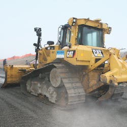
WSP quickly put the new GNSS solution to the test on a project known as the Newberg-Dundee Bypass south of Portland. On that job, a 4-mile stretch of highway built to relieve congestion on Highway 99W between the two named towns, the company used a Cat D6 running the Topcon 3D-MC2 solution and immediately saw its potential.
“We moved hundreds of thousands of yards of soil with the D6 on that job,” says Dodge. “In one area, we literally turned a small mountain into a pond, and we did it all with minimal staking. The results spoke for themselves and we realized this was the way we needed to go.”
No Stakes, No Problem
Today WSP runs four machine control systems, including Topcon’s latest mastless solution, 3D-MCMAX, and has regularly utilized them all. The paving division’s move to embrace GNSS has been rewarded nicely, nowhere more so than in one of the road projects mentioned at the outset. According to Dodge, even they weren’t prepared for the eventual results.
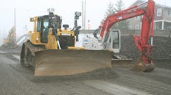
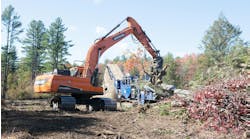
“The job was at Springtown Road and it involved intersection improvement, adding a turn lane—basically optimizing it for higher traffic flow,” he says. "We bid the job with the intent that we were going to have to manually stake and operate every foot of that job. Instead, we tackled it as an almost stakeless project, utilizing our Cat 349 with Topcon excavator machine control and the D6 running Topcon 3D-MC2. Doing so streamlined the process greatly.”
“Quickly” might be something of an understatement. WSP trimmed two weeks off the project's five-week length, a move that Dodge is only too happy to put into context.
“Saving two weeks on a six-month job is nice but cutting two weeks off a five-week schedule means efficiency and production have gone to a whole different level,” he says. “Because of the technology—and some excellent planning by our people—we got in there and just knocked it out. We weren’t really anticipating that.”
MAX Factor
While the addition of 3D-MCMAX was a natural progression for Wildish in general and WSP in particular, Dodge says the system’s combination of user-friendliness and productivity is proving popular with his operators.
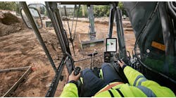
“I like the system because it is literally turnkey: you get in (if we took the controller out the night before, plug the controller in), turn the key and you are ready to work,” he says. “It is extremely smooth, and the calibration process is simple when compared to any other system out there. It seems Topcon has eliminated some of the measurements that, in the past, were either difficult to take or hard to understand. Now it is so easy that I’ve been able to teach some of our operators the calibration process so they can do some of that on their own.”
It should be noted that calibration is key in dealing with ongoing wear on a machine’s blade. In a month or less, a machine that was tightly calibrated and working well can start showing errors. “To keep that system performing at the optimum level, it needs to be regularly calibrated,” he says. “And if that process is complicated, people tend to put it off. That’s no longer the case for us.”
Similarly, cable wear, which can always present a problem for masted systems, has been eliminated. For Dodge, however, enhancing speed and efficiency has been the biggest plus. “I’ve heard from a number of our operators that, unlike some of the other manufacturer’s systems we’ve demoed in the past, with the MAX machine they can sit down, look at the screen and it all just makes sense— exactly what we need. We recently did an airport where we finished it with the dozer and just used a motor grader to get rid of the track marks. That’s pretty impressive.”
Accuracy In a Bucket
While WSP uses their GNSS-equipped dozers for everything from rough cuts to finished grade, as seen, their embrace of the technology extends to excavation as well. Using their Cat 349, the company has been able to quickly and accurately do projects that, in the past, could sometimes be a challenge.
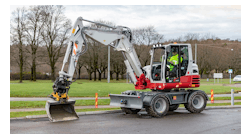
“Our ability to dig ponds and do slope work has improved tremendously,” he says. “Pipework is another area that’s been improved upon with the GPS solution. With it, we can simply drop a line into the excavator model and the machine just digs to that line. It’s so much easier than taking a level out there and having to shoot it over and over. One or two runs through the ditch and we are to depth; and with no one in the ditch, safety is improved as well.”
More to Come
Though pleased with everything that GNSS has brought to the table for them, Dodge says they realize there is still so much out there waiting to be tried.
“We will continue to expand the use of the technology to include graders, additional dozers, and excavators—we are even talking with the TSS about how it could help with rollers and compaction equipment. They’ve been outstanding for our company as a whole and we know they understand our needs better than almost anyone.”
According to Jeff Peterson, TSS’s sales manager, because Wildish’s capabilities are so broad, they are the ideal contractor to benefit from almost every GNSS product available. “There are so many solutions offered today—Millimeter GPS and SmoothRide for their pavers are just two examples—that they have the potential to reap the benefit of any of these emerging solutions. And they’re already well on their way.”
