Although the terms accuracy and precision get tossed around interchangeably, contractors are wise to be aware of the difference. Precision refers to the repeatability or reproducibility of measurement, accuracy to the degree to which a specific measurement represents a true value. Precision is a function of the system. Achieving accuracy is a matter of operation.
“It’s hard to make a GPS system more accurate,” says Chris Mazur, product marketing manager at Leica Machine Control. “That’s a function of the receivers and the measurements and the hydraulics of a machine. But if you’re diligent in your setup and you’re checking it everyday, you can insure that your system is precise.
“If you have set things up properly, then you’re going to get the accuracy that’s required,” says David Owens, vice president, GeoShack North America Inc. “If the equipment is performing correctly and the conditions are right, you should get the precision, the predictability. They’re both very important, but for some contractors, precision is as important as accuracy. Take a building pad that’s three- or four-hundredths high. It’s probably more important that it be level than two- or three-hundredths different from design elevation.”
“The two most important things I tell contractors,” says Mazur, “are check every machine into a known survey point on a daily basis, and at the beginning of a project, check one point in your data file to a point a surveyor has established. Machine-control products have become fairly simple to set up and contractors can get lax about checking into a control point. But whether you’re running a GPS system or a system with robotic total stations or lasers, bring each machine over to a surveyed control point and verify its elevation versus the elevation of that point. Ask your surveyor to give you a control point or two that’s protected and strategically placed on the job site. Also have him set one point on the project that you can find in your 3D file. Take your GPS rover and stake that point. If they match up, not only are you sure the control is correct, but you’re insured that your data is correct. Machine control doesn’t eliminate the need for surveyors, only some of the repetitive tasks they have to do. The fact is surveyors play a critical role in the success of machine control. They’re trained, licensed professionals-let them do their job.”
Bruce Flora of Flora Surveying Assoc./Data Pro Ltd. in Glenns, VA, agrees up to a point. “Automated grading from GPS-controlled machines is a fantastic tool to eliminate rework and increase productivity,” says Flora. “But just like any other tool in the contractor’s tool box, you have to learn how to use it.” Flora describes the need for contractors to acquire what he calls “a new skill set. You need some understanding of construction and how jobs are built. You need construction layout skills and some surveying with the basic understanding of the art and science of measuring and you need some basic understanding of engineering to “˜field fit’ design issues while staying in compliance. Most contractors have these basic skills, or they couldn’t be building things correctly. What they need is to expand them in relation to the technology. This requires some training. Contractors can gain the skill set to use secondary control,” says Flora, “but unless you have in-house surveying, it’s highly recommended that you hire a surveyor to establish the primary control.”
Matt Eklund, GPS program manager at Sukut Construction Inc. in Santa Ana, CA, confirms the need for a good relationship with your surveyor. “In order to be successful in GPS machine control, you have to have good site calibration, which you do in conjunction with your surveyor, and you need to have a good model. Hire a professional land surveyor and have him give you five or six control points around your site. There’s really no shortcut to that. After that, the contractor can handle the construction staking part of it. I do the GPS for the whole company, and I have six or seven people underneath me-there’s that much effort invested in getting it right. Contractors have to have a high level of respect for GPS and a willingness to take on the project of using it correctly. There’s a lot of stuff that goes on in the background that surveyors do, and contractors using GPS will have to adopt that same workflow.”
Common Sense Reminders About Job-Site Setup
“The setup of your GPS job site is what controls both accuracy and precision,” says Owens. He recommends a minimum of four control points and preferably more, depending on the size of the job. “In the best-case scenario, they need to be symmetrically separate and, if possible, evenly spaced. If you have a long, narrow project such as a highway, the control needs to be spread out. The wider the footprint and the more evenly spaced, the better the results you’re going to get in your localization.
“Because every GPS device on the job utilizes the base station to get its position, that base station must be protected and in the best possible position on the site, with 100% visibility to the sky-no trees, buildings or power lines, which emit a magnetic field that can impact your system. GPS works by reading a signal coming in from satellites in outer space, then measuring the distance and using basic trigonometry to calculate where that base station is. If there’s an obstruction, you run the risk of a false measurement. Position the base station where it’s unlikely that it will be moved, because every time you move it to another position on the job, you risk incurring error. The new point you set it on may not be exactly relative to the point you moved it from. If you can’t use a permanent type mounting such as a permanent pole in the ground, use a fixed height tripod in which you set the base station up over the same point at the same height every single day. Some people set it upon a standard tripod and measure up everyday and that leads to error.”
“Get the GPS base station up 6 to 8 feet in the air and driven in the ground so it’s stable in different weather conditions such as wind and precipitation,” says Jeff Drake, segment manager of machine control systems in Trimble’s Heavy Civil Construction Division. “Don’t set it up next to a building or against chain link, where it can be affected by the metal. For years we’ve been telling people not to do that, and we still see them setting up their base station knee high next to a chain link fence.”
When it comes to localization, Owens recommends fixing your rover pole on a bipod so it doesn’t move as you’re taking your control point shots. And make sure that your poles and your bubbles are calibrated. “Many contractors use an inexpensive pole calibration stand, and at GeoShack we will provide that service free of charge. Most people assume if the bubble’s getting in the circle, then you’re good. But it’s all relative. If the bubble isn’t calibrated with the pole, it will show you level, but your pole may not be straight up and down.
“Take at least a two-minute shot, preferably three minutes, which improves accuracy and gives you a truer result. One of the advantages that GPS has over optical instruments is that it will look at the entire job and tell you when you have a bad point. Once you have a tight localization, your job will fit and you can be very confident that your GPS positions will be correct.”
“There are all kinds of errors that can be made with GPS,” says Tim Edes at Eastpoint Lasers LLC in Hooksett, NH. “You’ve got to have an open sky, a good localization file, and enough localization points to tighten up the site. Ninety-nine point nine percent of the time, the equipment is fine. What you’re dealing with is an operation or setup error or math error. I’ve had a couple of instances where contractors were running on the same channel and were picking up their GPS corrections from somebody else’s base. I had one contractor who reported his GPS didn’t work, and when we out there, he had his base station set up under a big tree. Another contractor didn’t have his antenna screwed onto his radio; another didn’t have his batteries charged.
“We’re seeing a lot of people going right to GPS without buying a regular total station. But if you don’t have a total station and the surveyor’s given you two control points, you don’t have a way to put in more points. A lot of young guys have jumped right to GPS really not knowing what it does. I try to start them with a total station first. That’s part of why we started our class. [See “New Hampshire Grade Foreman Boot Camp,” Grading & Excavation Contractor, 1/30/2013.] The old guys who used to know the old way are gone, and there’s no place to get trained on what the system is actually doing.
“One of the beauties of GPS is that when you get out and do that initial localization, if you do a good job with it, you never have to do it again. When you’re sitting on these control points, your data collector will allow you to choose how long you want to stay on each point. Then it will average everything and store a location where you are. If you rush through that, take one shot here, one there-if you rush that initial localization, you’re going to have trouble later on.”
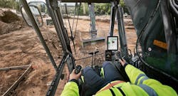
“With GPS, you’re managing by exception,” says Owens. With rovers, not only make sure your pole is set correctly but check into a control point or some kind of benchmark on the job every day, preferably once in the morning and once in the afternoon. As long as you have the correct measurements on the pole when you have it plumbed up and you have good localization file, you should be getting good grade on the ground. When it comes to the sensors on the machines, make sure that your measurements on your machine is correct. Your dealer will typically do that, but working conditions can cause those measurements to change, like the wear on the cutting edge. You need to have procedures in place to remeasure or recheck. You want to have a place where the operator can put both corners of the blade because you want to check the left and right side. Most contractors don’t do this. It’s a very bad habit not to get into.”
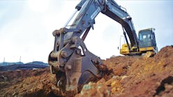
“Machine measurements are something that we typically train on,” says Drake, “because they can be a pitfall for customers. If you’re going to move the GPS receiver from one machine to another, remeasure the machine. If you replace a sensor and don’t recalibrate, you might see adverse performance of the system. Make sure the hydraulics are tuned properly for the material you’re working in. This technology is working in a very harsh environment and sensors or cables can get damaged or get water inside them, which can cause shorts. Those kinds of things are typical of the support calls we get and we try to educate contractors on.
“If you’re finding an issue with the machine, before you assume it’s the machine that’s wrong, have the surveyor come out and verify with the survey rover. If the rover is correct, then you know there’s something wrong with the machine setting or measurement or calibration, or whatever. If the rover and the machine are matching and it’s wrong, then you probably have something wrong with your base station. Or it could be your model. Maybe there’s a hole in it, a high spot.”
And errors can creep in seemingly from out of nowhere. Mazur points to the example of a contractor who had to rebuild a job because of a unit error. The survey and design team had set up the project in US survey feet, but in building the job, the contractor used international feet. The error was discovered after the road had been graded and the final survey determined it was off by 2 feet.
“Having good-quality data is obviously a huge factor in building a job correctly. Even with today’s sophisticated software, getting three-dimensional data of the site is still a challenge. The first thing we typically talk about with contractors is the challenge of dealing with digital data and the pitfalls of bad data. We educate them on the questions they need to ask the engineer or the architect and when they’re working with third party providers. Since we initiated SITECH, we have a number of companies who have requested a SITECH technician be on site to troubleshoot and catch things like a bad base station set-up, problems with the 3D data or poor performance with the automatics. Even if you have a qualified person on staff, that individual may not have the time to do this on a big project.”
“A lot of companies build their model piecemeal,” says Eklund. “But we take the whole model together. We go through it, checking our slopes and looking for holes, and present those inconsistencies back to the engineer. We call it a constructability study. We’re actually building the job twice, once digitally, where we iron out all the wrinkles so that when we put it in the machine and the rover, we’re going to stake out something that we can actually build. It avoids a lot of costs trying to do a redesign on the fly.
“Another problem is that a lot of companies put the wrong people in charge of the model. Our people are seasoned. They have been building jobs and converting plans to actual reality for 10 to 20 years. Some people think hiring someone who’s really good at AutoCAD is best. But it’s not about knowing AutoCAD; it’s knowing how to grade. A model can cost $25,000 if it’s done properly. A lot of people can’t wrap their head around that, but then they spent $25,000 on redos. If you work with a takeoff company or a model maker who says he’ll give you a model for $2,500, you’re going to get a $2,500 model that’s going to be full of errors.”
“Another good housekeeping tip,” says Owens, “is to keep your equipment firmware as current as possible. You can get into problems if you’re running a base station with new firmware and a machine with old firmware or vice versa.”
Augmenting GPS
“The application dictates the level of accuracy required,” says Randy Nolan, vice president and director of machine control, Carlson Software Inc. “GPS is weak on the vertical, so I add what I think of as a vertical base station to tighten the vertical accuracy, either a flat plane laser or millimeter GPS laser from Topcon or a robotic total station from any manufacturer to get the tight elevations. Look at what you use the machine on and your accuracy requirements, then chose a scalable machine control system that affordably handles the bulk of the work with scalable options, in case your accuracy requirements change. For scrapers and dozers doing rough grading or bulk earthmoving, all you need is our $20,000 basic grade. It’s only two components and comes with a three-year warranty.”
“In my opinion the only time in normal conventional construction you should be worrying about a quarter or half an inch is if you’re concerned with thickness and material yield,” says Flora. “You come in with GPS to put your dirt down, but you want something more from the dirt up to maintain thickness that’s going to affect the yield of the material. I personally believe that if you want true quarter-inch accuracy, you want to go with a robotic total station. There are some people out there using the laser successfully, and I’ve been impressed with it, but I don’t trust it on a consistent basis.
“Typically, GPS is good to anywhere from 500ths to a tenth of an inch in terms of accuracy at the blade tip,” says Drake. “In projects that need more accuracy, we see customers deploying our robotic total station-based solution, which provides a millimeter-level accuracy. We also have a laser-augmented GPS solution where we have a laser mast on the blade itself with a GPS receiver on it. The system replaces the elevation generated from GPS with the elevation it’s receiving from the laser receiver. It’s a great solution for sites that already have GPS.”
But Edes advises caution. “When you augment GPS, what you’ve taken a system that only has to have open sky for the satellite and tied it with something that has to have line of sight. Now you’re limited: You can’t go around corners, and if you lose sight of the laser or the robotic total station, your system’s down again.”
“We do Caltrans [California Department of Transportation] road base, which is quarter-inch tolerance, with GPS all day long and get passing grade,” says Eklund. “We don’t use total stations and we don’t use laser augmentation. Number one, our jobs are always staked, and Caltrans will provide a plan of pavement stakes. You have hubs in the ground that are more accurate than machine control, and the operator can graze over these hubs and basically adjust his grade up or down a few hundredths to negate any error he might have due to any sensors or GPS or blade wear. We do a daily check with primary control, have third-party certification of the finished grade by having an engineer check our work, and we induce redundancy by traditional staking. If we have to go back and fix maybe three or four spots, it’s much cheaper than having to set up a laser or a total station. You’ve got to have somebody on the ground to do that, and the whole purpose of GPS is to eliminate a grade checker and somebody on the ground.
“GLONASS is a must if you’re using GPS only. With American satellites, you’re going to get areas of the day when you only have three or four satellites. If you add GLONASS, you’ll have eight to 17 satellites and be accurate all day long.”
Edes reminds contractors that equipment manufacturers offer a download of free planning software that, once you enter your location, will tell you what you can expect for your satellite coverage for every hour of the day during the time period you specify. If you know the best coverage is between 1 and 3:30 p.m., you can plan your critical work for that time.
Using Lasers
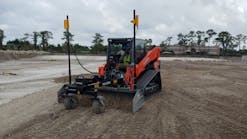
One of the problems we see with lasers is people trying to push the limits,” says Drake. “But if you work out past the 1,000-foot radius, you start to see adverse performance, such as not detecting the beam as strong as possible and losing laser strike, which is when we get calls that complain the system isn’t working. Lasers have difficulties with dust and fog and low-light conditions. There are other common sense problems such as making sure the laser has a good source of power for the operating period. You want to make sure your lasers are continually calibrated in terms of level performance or slope performance to represent the kind of slope or level plane you expect to be working with. Otherwise lasers are pretty straightforward technology.”
As long as they’re used correctly, Edes says. “Let’s say the manufacturer’s stated accuracy is guaranteed at a sixteenth of an inch within 100 feet. If it’s a sixteenth of an inch at 100 feet but your job site is 800 feet long and if you don’t move it, by the time you get to 800 feet, it can be a half-inch because the error is cumulative. If you want to be extremely accurate, stay close to the laser.”
Other errors accumulated from 30 years experience: “Strobe lights on top of construction trucks affect lasers. People have had to block off their strobes or turn them off. On some of the bigger jobs, the different trades will each have their own lasers set up, and if you’ve got one that’s set up an inch different, you can be picking up someone else’s laser beam on your receiver. We’ve had a lot of guys do half a day’s work off the wrong laser. Obviously try to be aware of everyone who’s out there and be sure to set up your laser with a big enough difference in elevation.
“We’re seeing the calibration coming from the manufacturer is not nearly as good as it used to be, so make sure the laser has been calibrated correctly before you take it out on the job site. If you’re working in an urban area, watch out for windows. We had one instance where the beam was bouncing off the windshield of the bulldozer and we had to cover that spot with cardboard. Always set up the tripod facing into the wind and with the third leg situated between your legs so the wind blows against the leg rather than through the empty space in the tripod. Weight down the tripod when you setting up in the wind. As long as you keep the lenses of the lighthouse clean, working in dust is not a huge problem, but you should have the laser cleaned and calibrated more often. If you’re working in the rain, wipe off the laser after your use it and make sure you keep the case closed. We had one guy who left the case open and stored the laser in a case full of water for a weekend.”
“I’ve never met a contractor who didn’t want to learn the right way to do things,” says Mazur, who stresses whether it’s lasers or GPS, the goal is another tool for your toolbox to help you become more efficient and better at moving dirt. But it takes time and commitment to set up the system to take advantage of its inherent precision and attention to detail to achieve the accuracy you’re aiming for.


