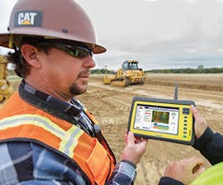
Machine control systems are receiving a more enthusiastic response in the industry than telematics, primarily because they bring money to the bottom line in a more direct way. But as contractors learn what data is available on telematics systems, they’re expanding their use of those systems as well. The end result is a seamless flow of information between servers in the office and machines and rovers on the job site.
Solutions From Topcon
From Topcon comes Sitelink3D, with which every machine on a job site has Topcon’s grade control system or an HT-30 haul truck module. Topcon introduced the HT-30 at CONEXPO, and it features a small, portable GPS-enabled control box that mounts into the truck cab. As the truck is loaded, data about the load is entered, such as material type, driver, and quantity. The load is then integrated into Sitelink3D and can be tracked for scheduling, rerouted if needed elsewhere, and recorded once delivery is made.
With Sitelink3D, a remote manager can connect to a grade-control enabled machine and control the operator’s GPS system. “You can send new or modified files directly to the machines from a remote location, change offsets, and generally support the machine,” says Mike Wehling, Enterprise 3D specialist with Topcon. “I use it for training. I could get an operator up and running in 10 minutes versus sending somebody out there to teach him the system. We can send design files to the machine.
“This system can be especially useful on big design/build projects, where construction often begins before design is complete,” says Wehling. “With those projects you will typically get a lot of changes, and with Sitelink3D you can easily keep all of your machines updated with the most current information. I can send data to one machine, or to all of the machines, even if they are turned off. When an operator turns on the machine, he will get the data from the server.
And Topcon has another step forward. “Once we have established that connection with Sitelink3D, we can add Enterprise, which adds productivity to the mix,” says Wehling. “Let’s say that you want to move pile A to hole B. “If you take pile A and move it to hole B. Using Enterprise, we can define that task exactly as we bid it: which machines are going to move that pile, from where, to where, when we are going to start and how long it will take. This establishes a baseline to measure our success against. Now Enterprise can use the geo-referenced data provided by the machines to show if we’re making money or not, in real time, before it’s too late.”
Leica Is Simplifying
From Leica Geosystems comes iCON Telematics. The system has three categories of features: Sync, Track, and View. The Sync feature allows a design file, or design data, to flow from an office server to machines and rovers in the field. “When you have a new model that you want everyone to use, you can push that out to everyone so they can use the same model,” says Thibblin from Leica. “If you do some adjustments or you measure something with the machine, or you measure something with your rover, you can push that to another machine or to another person on the site, or you can collect it in the office on the server.”
“With the View feature you can connect to a machine, from a remote location, in real time,” says Thibblin. “So if you are Leica Geosystems, or a dealer of ours, or the head surveyor for the contractor, and you have an issue with the machine or you want to help the operator, we can view the operator’s screen remotely, in real time, so we can see exactly what he is doing. We can take over his screen, and we can teach him, or we can help him, or we can fix his problem. And that can be done from anywhere.
“The Track feature is basically giving us the historical data of where the machine has been and of course where the machine is,” says Thibblin. “The good thing is that it is using a background of a Google map, but of course you can add the functionality of the design data of the project as well. And then you can see exactly where the machine is. You can also see when it started, when it stops, and then of course you can find out why it stopped. And you can make sure you know the uptime of the machine and then you can do some evaluation of efficiency.”
Leica’s iCON Telematics permits one to do reports on uptime and to compare the productivity of one machine to one or more others. “Basically you can see where the machine has been and its uptime,” says Thibblin. “Those are the foremost things you can do.”
In terms of machine control, Leica Geosystems is setting new standards for ease of use, says Thibblin. “We are simplifying more today to make sure that you don’t have to be a nuclear scientist to operate all the functions of a machine control system,” he notes. “When a company buys a 3D dozer or a 3D excavator, often they use only 20% of the possibilities. So we’re making sure that the features and functions are easier for the end user or construction surveyor.
“We have a Dual Mast solution for Six-Way blades that we released about a year ago now,” says Thibblin. “But that’s not the real kicker. The kicker of it is that we are using an SP Technology sensor, which means speed and precision. That’s a sensor that is actually helping us to be able to very precisely measure and control the movements of the blade at very high dozer speeds—to make sure you have a smoother ride for the blade. So basically all in all, you are performing much better with the system because of this SP Sensor. We need to be able to provide systems that are accurate at high speeds. You could say that this is a very good high-speed system.”