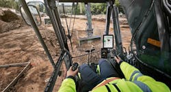
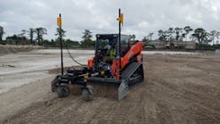
Now is the time for machine control and construction management software, notes Matthew Gebarowski, owner of Dirt Logic, a company that provides earthwork takeoffs and GPS modeling services. “It’s not too late to get into it; it’s not too early,” he says. “We’re right on the cusp. If a contractor wants to stay competitive over the next year because other contractors are not getting into it, it’s a good time to do so.”
Software that helps contractors manage a construction site is becoming more widely implemented with equipment manufacturers laying the groundwork for its use in their equipment, notes Gebarowski. “The Komatsus, the Caterpillars, the John Deeres—they’re all coming equipped and ready to go with it, whether a contractor wants to rent the equipment or buy it. It’s becoming standard,” he says. “Since the machines are coming fully equipped for this technology, it only makes sense to use it.”
Mark Larranaga, senior manager for software business development for Topcon Positioning Systems, agrees that as manufacturers have started to integrate GPS for grade control within their machines straight from the factory, construction management software is becoming more widespread.
“Even machines that don’t have that capability are being outfitted to have GPS on them because software is a major factor in what they need to do to control that project,” he adds.
Justin Smith, product manager for excavation packages for Roctek International, notes that the industry’s larger players have been using software functions over the past decade. “However, software has been getting cheaper and easier to use,” he explains. “Because of this, adoption rates are much higher in the small- to mid-size contractor companies than they have ever been.”
And Greg Norris, spokesperson for B2W Software, concurs. Software is widely used and highly proven across heavy civil construction workflows, he says.
“Still, the construction sector, in general, trails other industrial sectors in employing the most advanced software capabilities to maximize performance,” he adds. “Another major challenge now is for construction companies to evaluate the many options available and to develop a cohesive software strategy to eliminate the inefficiency and headaches inherent in managing independent, disconnected software applications. This is where a platform approach for estimating and operations provides significant advantages.”
Alan Sharp, business area director of strategic software solutions for Trimble’s civil engineering and construction division, notes that Trimble software is designed to connect people and machines across the entire life cycle of a construction project. “Our software helps create a connected job site, which includes a mixed fleet of earthmoving equipment all communicating with each other, as well as sharing information on progress, diagnostics, and updated construction models back and forth between the field and the office,” he says.
Trimble’s software solutions address three primary components of job-site connectivity:
- The office, in which project leaders are in constant wireless communication with workers in the field and machines over the Internet;
- Connected machines, which enable operators to send and receive information and designs from the office to the machine on the job site; and
- Connected controllers, which enables everyone on the job site to share information quickly.
“Although we have a full suite of software solutions for the construction industry, our Connected Community software is the backbone of a Trimble Connected Site,” says Sharp. “Connected Community allows users to manage and share design files from Business Center–HCE over the Internet.”
Business Center–HCE software is designed to make it easy to create accurate, integrated three-dimensional (3D) models for construction projects as well as provide sophisticated tools for managing field data, data prep, site takeoff, and road takeoff, among other functions.
Connected Community also is designed to make it easy to access asset and site productivity information from VisionLink, Trimble’s asset and fleet management software, Sharp says.
“By providing software solutions that integrate construction technologies, we are giving contractors insight into meaningful data and overall greater insight across the project,” he explains.
“This means contractors can work more efficiently from the bidding process through handing off the project to the client,” continues Sharp. “Contractors using Connected Site software are better equipped to identify problems and changes needed early, which minimizes rework and the underuse or overuse of materials. Tighter project monitoring, better visibility, and overall cost savings are additional advantages gained by the use of construction software.”
The Trimble civil engineering and construction division is developing solutions that span the entire project life cycle continuum. Included in that is Quantm Alignment Planning software for initial project planning and feasibility, Novapoint software for detailed civil engineering design and Business
Center–HCE for construction operations planning and execution, including bidding, estimating, construction modeling, and field data management.
Also included is TILOS for construction project planning, scheduling and progress management and VisionLink for fleet and operations monitoring to as-built approvals and project handover.
Within the Trimble portfolio, products can be divided into three main phases of work: design solutions (Quantm and Novapoint), construction solutions (Business Center–HCE, TILOS and VisionLink), and the addition of software solutions for civil information systems coming soon, notes Sharp.
For modeling from a design perspective, “this means using Quantm to find the best possible and most cost-effective route for a highway or railway in both horizontal and vertical components that fits the restrictions that need to be honored, such as land ownership, environmental, existing infrastructure, terrain and geological considerations and more, to the use of Novapoint Civil Design Suite to carry out a detailed civil design for the project,” says Sharp. “In these scenarios, the design is being done utilizing design standards for the region and design criteria for the project, such as road type, driving speeds required, and rainfall to be managed.”
Two elements must be considered from a construction perspective, says Sharp. “The first is that design is often delivered in a non-3D form, such as paper plans, PDF files, 2D CAD, or partial 3D civil design,” he says. “In all cases, there is a data preparation process contractors go through to convert the provided data into a full 3D model suited to construction operations.
“The second part of construction modeling is to take the detailed 3D design and to make it constructible. This takes the specifications and tolerances for the project, the work methods to be used by the contractor, and the work breakdown structure that the contractor needs along with necessary design adjustments that are needed to be able to construct the model.”
The modeling process is used for both field operational requirements to run survey, site positioning and machine control systems and to facilitate take-off to determine or verify all of the material quantities for a project that can be used to carry out the estimate at the bid stage of a project, notes Sharp.
For operational planning and execution, “the 3D constructible model is just the starting point of construction operations,” he notes. “The contractor now utilizes the model to determine the operational plan. For example, the design model—with the road superstructure removed—provides us with an accurate 3D model of the final earthworks required and they have a model of the existing terrain.”
The contractor then knows what equipment methods to use on a project, such as dozers to move dirt short distances, scrapers to haul dirt intermediate distances, and an excavator and truck combination to haul dirt long distances. “The combination of the surface
models and the equipment methods are used to determine a mass haul plan, creating the executional model for the earthmoving fleet for the project,” says Sharp, adding the model is further optimized through the knowledge of the construction project, such as costs associated with individual techniques regarding materials hauling.
“The mass haul plan then quantifies and identifies a series of tasks needed to be executed with different fleet groups that can then be planned and scheduled using the TILOS software,” he continues.
The TILOS software then creates a detailed plan for the entire project with a resource requirements analysis including machines, operators, fuel, and water for compaction effort, or dust suppression that can be analyzed and adjusted to optimize the operational plan.
“Additionally, TILOS can assign seasonal production rate variations and can analyze environmental constraints that may affect the construction operations,” says Sharp, adding that all happens prior to moving any dirt in what is termed 4D/5D construction operations planning and combines the 3D model with material, labor, equipment and construction methodology to determine an optimal solution.
Once construction starts, the surveying, site positioning and machine control systems are all collecting data during operations. The data collected by the equipment executing the defined tasks is combined with manually measured and observed results and captured against the constructible model to monitor the progress, productivity, and quality of the executed tasks, such as earthworks, compaction, and completed utilities.
VisionLink provides fleet management and operational management controls that offer rapid insight into project operations as they are taking place, notes Sharp. “Fuel can be delivered to equipment as it is needed, machines can be more fully utilized to increase efficiency and eliminate bottlenecks, construction progress for compaction and earthworks can be monitored in near real time based on machine-captured information that develops a real-time surface model,” he says, adding the model can be used to monitor volumes moved, elevations graded, and material thicknesses laid, as well as the quality and consistency of compaction over the entire constructed area.
In addressing a number of different disciplines, the engineering team needs to work with the contractor, sub-contractors, and owner collaboratively on projects, Sharp points out.
The office and field staff and machine operators also need to work together on projects, he adds. “Data of a wide variety of types from design models to as-built and work in progress data needs to flow bi-directionally between office and field,” he says. “Problems encountered need to be communicated and captured digitally; responses and redesigns need to be carried out and transmitted to all stakeholders. The collaborative effort needs to be supported with strong collaboration tools.”
To address that, Trimble’s CEC portfolio offers a variety of tools for collaborative purposes.
The Quadri Model Server is a central point to which software-authoring applications such as Novapoint connect in order to share and receive design model elements. The Quadri Server can be placed inside a corporate firewall or outside on a hosting service.
The Quadri Model stores all of the model information for a project in a task model that tracks where the data came from and when and how it was created. The results are stored as
features and objects in the database, allowing the users of the data to access it from the task or feature model.
The shared data can be managed to be edited or not edited. “The key value of the Quadri Model is that it is a central database, not a large number of interlinked files,” says Sharp. “It is truly a one source of truth in that it allows engineers and contractors to share information at BIM object level quickly and efficiently across office, corporate, discipline, geographic, and time zone borders.”
Easy Access is a Web-based portal that facilitates efficient sharing of information, as well as communication around the BIM model between stakeholders who are not experienced with the model authoring tools, says Sharp.
The portal is designed to provide rapid and simple access to shared model presentations geolinked to the Quadri Model, facilitating accurate position-based capturing of model issues in a collaborative way, he adds.
Connected Community provides a set of tools connecting field operations such as machine control and site positioning systems equipment to the office. “Office staff can remotely access the field equipment to provide support, training, or to troubleshoot problems,” says Sharp. “The office staff can rapidly distribute design models to the field systems, eliminating drive and distribution time, and ensuring all machines and site positioning crews have the right information available all the time.”
The GPS infrastructure for a project can be supplemented by the Internet Base Station Service, allowing GPS corrections to be delivered over long distances to remote machines and field crews using cellular or Wi-Fi technologies, providing increased operational flexibility and the ability to start working in new project areas more quickly with significantly lower expense and mobilization times, he adds.
Among the contractors using Trimble’s technology is Kuersten Construction. The company was recently hired by Piceance Energy as the civil contractor to build two reservoirs for the Harrison Creek water impoundment project in northwestern Colorado’s Piceance Basin.
The lined reservoirs are used for storing fresh water for future oil and gas drilling. The 50-acre site has extensive grade variations, slopes, and swales and required moving almost 400,000 cubic yards of dirt, “all of which made it perfectly suited for grade control technology,” says Sharp.
The Kuersten team uses Business Center-HCE to prepare data for the build and to develop 3D site models. The designer collects information from the surveyors and the engineers and coordinates with the site to ensure the data matches.
The data is then loaded into the control boxes and shared with the field personnel to ensure all machines are reading the correct information. For the project, Kuersten excavated 400,000 cubic yards of dirt “and met design targets without pounding a single stake, all in less than three months,” adds Sharp.
The Kuersten team also mounted a SPS985 GNSS modular receiver as a rover solution on a utility terrain vehicle (UTV) to measure quantities at the job site. The rover and UTV collected volume data to create a baseline, which was then shared with the client’s surveyor to ensure everyone was in agreement on baseline volumes.
As the earthworks progressed, the team used the rover data and Business Center-HCE to create quantity reports, which they included with their pay application.
This quantity documentation eliminated mistakes in measuring or recording the volume of dirt moved, which helped the company get paid quicker and with less pushback, says Sharp.
John Kuersten, owner of Kuersten Construction, notes that his company’s managers and clients appreciate the ability to create accurate quantity reports. The client’s surveyor had walked the job and couldn’t find anything more than 3/100 of a foot off design, recommending to the client to not invest money in a surveyor, he adds.
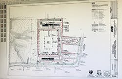
A Precision Site Development drainage plan
Bassem Hamdy, spokesperson for Procore, notes there are key factors enabling construction management software to propel a company and a project to be more successful.
The first: “a construction management package should be collaborative,” he notes. “Collaborative solutions require a high level of ease of use. Collaboration dictates that some people don’t necessarily work for you, so you can’t spend hours training them. It needs the ability to scale hundreds of users with no additional cost.”
Procore offers an unlimited user model, allowing anyone from the architect to the subcontractor to the owner’s representative to easily communicate collaboratively through the software, Hamdy adds.
Second, software needs to be mobile, says Hamdy. He points out the manufacturing industry was the first to introduce innovative control software, adding that “manufacturing is a lot easier than construction. Construction happens in the field. It doesn’t happen in a climate-controlled factory, so mobile brings the technology to where the work occurs.”
A third aspect is the ability of construction management software to be able to communicate with multiple software packages. “Not any one solution does everything, but you do need a hub that can communicate across platforms so that data is transferred as easily as collaborative users can log in,” he says.
When Procore designs software, the company flies in clients prior to doing any major development project to “sit down with them and develop the software from the ground up,” says Hamdy.
“All of our development is user-centric,” he says. “We watch people using the software and that creates something that can be adopted in days and weeks, not months and years, which drives the ease of use.”
The earlier a contractor uses the software in the project, the better, notes Hamdy.
Procore has a drawings tool “that really drives a lot of benefits early in the supply of construction with design help and design iteration all of the way to the bidding and procurement and project execution,” he adds.
Software needs to provide the ability to do drawings and specs, says Hamdy.
Some contractors would create a database, automating Excel spreadsheets with rich data from construction drawings and specifications, and transpose it into a list, “which is not really the way people build,” notes Hamdy.
“They don’t build in Excel spreadsheets or rows and columns—they build off of drawings and specs,” he adds.
Hamdy concurs with others in the industry that construction management software is a given for large operations and is starting to replace Excel spreadsheets in small and medium firms. He is noting increasing interest in Procore’s cloud-based offering, mobile adaptation, ease of training and ongoing support. Because it is cloud-based, it is constantly updated by the company.
Hamdy notes the software is easy to set up in an analog environment. “We have two very large enterprise clients who went live with 100 projects in four weeks,” he says.
As for upgrades, “we have a development cycle where we literally do upgrades almost every day, transparent to the user,” says Hamdy.
Procore is an open platform and offers an app store with 35 apps.
Some in the industry question why the company would open the door to potential competitors. “This is for the betterment of the industry,” says Hamdy. “We are citizens of the construction industry. We give our software free to more than 100 construction management university programs across the US Construction management students are leaving with Procore experience.”
That also addresses the current “war for talent” in the industry, notes Hamdy. “You pick up an individual from a university and they know how to use the construction management software out of the gate,” he points out. “That saves you a lot of time and money.”
Procore also is hosting a technology conference in Austin in March called Groundbreak. Among the many speakers: Mike Rowe, formerly of Dirty Jobs, whose Mike Rowe Works Foundation provides scholarships to students pursing a job in the trades.
Larranaga says Topcon Positioning Systems has a program focused on allowing a contractor to bring in various file types from civil engineers or other outside sources “that they need to use and create information themselves into a useful form for machine control.”
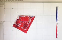
EarthWorks software by Trakware
Topcon has an office application that builds a model but also has a direct connection to the field, “so there’s no longer the need to drive out and set those machines with new files each day or each change,” says Larranaga.
“They can do it right from their office,” he adds. “Once it’s been completed, Sitelink 3D allows them to send that information instantaneously to every machine needing that new file. There’s major savings from the perspective of travel time to actual cost of fuel.”
The use of the software affects all aspects of the operation, from the beginning clearing of the job, through to the finished as-built, notes Larranaga.
It records data throughout the time on the job site so that through the various stages users can utilize the files, and as the information is being recorded it also can be archived, used for submittals, and from a volume standpoint, the project will be set up in the servers with anyone given access having the ability to log in by permission, says Larranaga.
Topcon runs update throughout the year as the software continually evolves and alerts end users of the availability of those updates through the company’s website. The software can be set up in an analog environment, Larranaga adds.
Dirt Logic uses different types of software to build the data for construction management in the GPS machine control, notes Gebarowski. “It automates all of the equipment,” he says. “Komatsu has a full line of equipment where it is already embedded in the machines; John Deere is coming out with the same thing, and Caterpillar is right on the cusp.”
Dirt Logic uses different software such as Ag-Tech, AutoCAD Civil 3D from Autodesk and Carlson to “generate the perfect data to go onto those machines,” says Gebarowski. “Some contractors like to use their own in-house, or they’ll use a surveyor,” he adds. “We are the hybrid of all of that to build data just for contractors. We only work with contractors.”
The most effective approach is to utilize three or four different software products to get the perfect output, says Gebarowski.
The Dirt Logic machine control is most useful during the grading stage, whether it’s a 2- or 200-acre site, and is now also showing advantages for utility pipe excavation, says Gebarowski.
The primary advantage of using the machine control for excavation contractors by Dirt Logic is not having to wait on a survey, notes Gebarowski, adding that the number of people entering the profession is not keeping pace with the vast numbers of those retiring so the technology fills the gap.
Production gains are a second advantage. “Production is going up at least 10%, and I’ve seen it the most 40 to 50% in production rates increase,” he says. “Less labor and less equipment is needed. All around, it brings bidding in at least 15 to 20% lower.”
Because technology is changing on an ongoing basis, so is software, notes Gebarowski. While some software users have had to put the software on a USB and plug it into a system, that is now “old school” as equipment manufacturers and dealers are providing a solution that enables contractors to upload and download all of the software updates, says Gerabowski.
Gerabowski notes it’s becoming simpler to set up the system in an analog environment, “depending on if you’re living in a rural area or near a big city. It depends on your clearance to your GPS and cellular data. You have to be able to use a cell phone to get Internet, to get the system to work.
Colin Heidel is a contractor who favors the use of construction management software in order for his company, Precision Site Development—a small site work contractor specializing in underground utilities and earthwork—to provide optimal service in the greater Cincinnati, Dayton, and northern Kentucky areas.
Heidel uses EarthWorks excavation software by Trakware, choosing it for its “ease of use, as well as the cost of application and the excellent customer support.”
“We use it in-house for earthwork take-offs, calculating the cut and fill, and also the fine grading,” he says. “One of the benefits of using it is that it has very nice, easy-to-read colored reports and maps that I can provide to my field crews. They can get a good idea very quickly of the magnitude of the cut and fill work.”
Heidel—who indicates he uses the software multiple times weekly—says he likes that EarthWorks features a list of various tools and a “fail-proof” checklist.
Gregg LaPore, Trakware’s CEO, notes that the company designed the estimating software to allow contractors to estimate excavation volumes and material quantities in a manner that is “affordable, simple, and straightforward.”
For many contractors—including those not used to using software on the job— ease of use is important.
Trakware’s software has 6.5 hours of built-in training videos, and the company runs five training classes weekly. “We have more than 4,000 customers and average three support calls a day, so that offers an idea of its ease of use,” points out LaPore.
B2W monitor and iPad
Trakware’s software offers the advantages of “more effective bidding, faster bidding, and more accurate bidding without breaking the bank or sending you back to college for a month,” says LaPore.
It is most useful in the bidding or budgeting segment of the construction process, he notes. “A general contractor wants to know roughly how much it is going to take to do the dirt work for the site. You can use it to get budget numbers. For excavators who will actually be executing the project, you would be able to figure out excavation quantities and go ahead with the pricing based on those numbers.”
The software is used most effectively by those who are currently “guesstimating or doing take-offs by hand,” says LaPore, adding that while it is possible to do them by hand, it takes significantly longer and the accuracy isn’t necessarily the best.
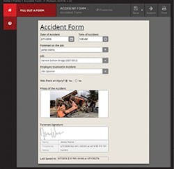
A B2W accident form
“You want to have software that helps you figure out accurate quantities so you can bid or budget properly,” he adds.
Trakware doesn’t require updating unless technology changes, notes LaPore, adding the software can run anywhere on any PC in a Windows environment.
Roctek International’s excavation takeoff software is not just a new way to do takeoffs by hand, explains Smith. “Properly used, it will drastically save time, reduce cost both directly and indirectly by reducing errors, allow for better job planning and help increase profit margins on jobs where before the estimator would have been unsure,” he says.
Roctek’s software is most useful in the job phase of evaluating which jobs should be bid, winning the bid, planning the job and in assisting in producing 3D models for machine control systems, Smith points out.
Advantages gained by its use center on having an increased amount of time to spend on other construction tasks, including extra time to bid additional jobs while being more precise than what is possible by hand, Smith says.
Additional benefits include confirmation of bid quantities against actual when used with machine control systems, he adds.
Smith notes Roctek’s software is “easier than it has ever been” to set up in an analog environment. “We can personally have a copy sent over and an application support specialist walk a new user through their first takeoff, usually within an hour of the first call,” he says.
Norris notes that across heavy civil construction sectors, margins are shrinking, competition is intensifying, and projects are getting larger and more complex.
B2W Software focuses exclusively on heavy civil estimating and operations—the areas in the construction workflow where profits are won and lost, Norris points out.
B2W Software’s ONE platform is designed to address those pressures “and enables companies to win more jobs and complete them more profitably by optimizing accuracy, speed, efficiency, collaboration, and data across their estimating and operational workflows,” he adds.
The B2W Estimate application allows companies to estimate more accurately to win more jobs at better margins, says Norris, adding contractors can bid faster and with less effort, utilizing centralized cost data and specialized features.
B2W also provides applications for resource scheduling, field tracking and analysis, equipment maintenance, and data capture and analysis. “This operations platform streamlines processes, eliminating inefficiency, inaccuracy and delays,” says Norris.
Norris points out that individual applications are part of the unified ONE Platform for estimating and operations, “which integrate seamlessly with the greater construction management ecosystem, including accounting, ERP, and project management systems.
“There is one shared operational database for information like employee, equipment and job lists, and a logical, collaborative flow of information across the applications in real time,” he says. “This connects people, workflows and data across the enterprise, enhancing efficiency, collaboration, and data-driven decision making.”
Addressing how software is only as effective as the ability of the end user to easily employ it, Norris says that “construction companies that move from manual systems or spreadsheets to specialized B2W software applications tend to be surprised by how quickly their teams learn the software and embrace the advantages. This is due to the fact that the applications have a Windows look and feel, and are designed specifically to be intuitive and easy to use in a construction environment,” he adds. “Construction employees want to use the most advanced tools available in order to excel at their jobs. Some initial resistance to change is not uncommon, but that disappears quickly when employees see that the software makes it easier for them to do their jobs and perform at a higher level.”
With dozens of pieces of heavy equipment and trucks in his company’s fleet, Doug Tait, president of W. C. Spratt in Fredericksburg, VA, has a lot to track. His company started using B2W software after errors on spreadsheet calculations many years ago caused his company a significant loss of money.
“We produce more bids than we can physically do without the software,” points out Tait. “We are able to track our work in the field better than we could without the software. We are able to produce estimates using our accounting program much faster than by hand. The maintenance program has given us 360-degree view. We can see where things are, what they are doing, where they’re going to be next week, and if there are any issues with what’s operating.”
The software is user-friendly, Tait notes. He lauds the software company’s support, which is important to him as downtime costs money. “I get an answer within minutes no matter what time of the day it is, no matter what day it is,” he says.
