A few decades ago, the technology that exists today wasn’t even on the radar for contractors building or repairing roads. Today’s software technologies can help contractors build roads that are more resilient and last longer.
“The construction industry was one of the last industries in the world to automate,” notes Bill Painter, Topcon’s senior manager for paving projects for OEMs. “The auto industry was probably at the forefront of the automation of building cars, but now we're getting the contractors into the thought of using automation to build these roads.
“It’s growing very fast. The industry is starting to take it on much more than they did in the beginning. Technology allows us to be in that millimeter accuracy. When you can build a road to that precision, the road is going to last longer.”
B2W Software
Estimating is the foundation of road-building, giving the contractor profitability potential, notes Greg Norris, B2W Software spokesperson.
While some road builders and paving companies still use spreadsheets and “home-grown” estimating programs, “specialized software essentially provides huge competitive advantages in terms of being able to complete estimates faster, do it much more accurately, and be more confident in the accuracy of the estimate,” Norris adds. “The advantage is in the accuracy so you don't make formula errors that might carry over from one spreadsheet.”
B2W Software has built-in "construction logic" that can be easily picked up no matter what the experience level of the estimator, says Norris, adding that the logic behind it is similar to using paper-based estimates.
B2W Software’s Estimate Error-Check Wizard was designed to spot mistakes, potential mistakes, and calculation errors to ensure accuracy and reliability in producing a bid. Information can be aggregated from previous bids to pick up trends where a contractor can make or lose money to focus on strategy.
With one unified platform, end-users can access data from across a variety of components such as dispatching, field tracking, and equipment maintenance.
“Once someone wins an estimate, the data from that estimate can be pushed seamlessly to the field tracking element to set up the field logs into the scheduling element,” says Norris. “Automating the preventive maintenance makes sure it gets done on schedule.”
Data capture and analysis are executed by B2W Inform, a cloud-based business intelligence program that fills in the gaps with a single database for operational data leading to actionable business intelligence.
The technology can be a recruiting advantage, Norris notes.
“In the past, people have sometimes shied away from technology, thinking that it's too advanced for the construction market,” says Norris. “But what we're seeing now is that newer employees—especially younger employees—expect that kind of technology. To have an online-based software tool in place for these different workflows is an advantage when you're hiring your employees.”
HCCS Software
HCCS Software is designed to fit into the entire process for concrete road-building.
The process typically begins with the estimate, notes Mike Williams, senior product manager, adding that HCSS HeavyBid is used for earthwork, underground work, grading, paving, pipeline, plants, and other heavy construction estimating requirements.
“In HeavyBid, estimators can essentially transfer the information from the owner’s plans and specifications into a detailed estimate of all activities required to complete the project,” says Williams. “This includes estimating all self-performed work, subcontract work, labor and equipment, and materials required.”
Using HeavyBid, estimators can add notes specific to each activity, which will copy over to HCSS HeavyJob for use in that system. If the job is awarded, the estimate is typically exported over to the company’s accounting software to track the project for the activity codes.
The same estimate can be exported/imported into HCSS HeavyJob and used for the construction phase.
Estimators can use HCSS Plans to assist with the sophisticated take-off of quantities using built-in calculators for items such as excavation cut/fill quantities, asphalt quantities, or concrete quantities.
Once the paving job has been awarded, the estimate is sent to accounting and the project is set up in HeavyJob to help manage the construction.
The HeavyJob Mobile App is loaded with the list of jobs and cost codes/budgets, employees, and equipment via an interface with the contractor’s accounting system. This provides foremen with the resources required to track their work and enter important daily project information for their crew.
Foremen have access to current digital plan sheets using HCSS Plans to review for the area in which they are working, review the details or specifications, and add annotations to the plans for others to see or for future reference.
The HCSS Skills System is used to determine if crew members have the required skills or certifications—such as for confined space—before performing this work.
“If they have subcontractors working on the project, they can record the size of the subcontractor’s crew and the work performed,” says Williams.
“Foremen have access to the latest information for ongoing RFIs or submittals due to the connection between HeavyJob and HCSS Project Management. When they have completed their time card, the foremen can send it to the office electronically along with their notes and other information.”
The HeavyJob Manager system can be set up as either a desktop or web application and contains the master lists of jobs, cost codes, budgets, employees, and equipment, typically updated automatically from the contractor’s accounting system.
The HeavyJob Manager system receives the digital time cards and diaries sent in by the foremen, who use the time card information to provide timely reports for items such as labor costs, equipment cost, productivity, and material tracking.
Topcon
Topcon has the technology to turn a road construction plan into a visual 3D model that can be shared instantly with heavy machines such as motor graders, bulldozers, excavators, and pavers, on active project sites.
“We can use that plan on those machines starting with the rough grading, the subgrade, and the finished grade,” notes Painter.
Topcon’s Millimeter GPS is a laser-augmented device offering millimeter accuracy for precision on the job site.
“There are a lot of tight tolerances on these jobs because materials cost as much money as they do,” says Painter.
A sub-grade can be executed within a millimeter of accuracy.
All of Topcon’s products can be used on multiple machines rather than having to use different types of operating systems for the finish machines, Painter points out.
“The same device we use on our motor grader, we can take that off and put it on our concrete paver and pave the finish grade with that, whether it be concrete or asphalt,” he adds.
Topcon offers local positioning systems (LPS), which are robotic total station solutions. They use a robotic total station and a prism on the machine that offers accuracy within millimeters for a concrete or asphalt finish grade or subgrade.
Topcon also offers intelligent compaction for roller systems.
In areas where the life of a road may be shorter due to weather conditions, no technology can mitigate the effects of frost that cause a road to move, heave, and bust up, Painter points out.
“But if we can make the road more accurate from the start, instead of having to replace freeways every two years, maybe we can stretch that out to four years with the technology that Topcon offers,” says Painter.
Topcon’s SmoothRide is an asphalt road resurfacing system using an RD-M1 road resurfacing scanner that the contract uses to scan the road to be paved. It scans bumps, variations, and poor road surfaces into Topcon software, which generates a model that is put into an asphalt paver used to pave over the rough surface, making a smooth ride possible.
“The issue with asphalt paving is it's always been kind of a guess as to how much is needed to make it smooth,” says Painter.
The RD-M1 scanner technology can also be used to ascertain the success of the finished road product.
“All contractors, whether they're large or small, are realizing that they need to get into the automation business to be competitive,” Painter points out. “All of these jobs are so closely bid that if they don't offer automation technology, they're finding they can't bid tight enough to get those jobs."
Trimble
Trimble software drives a construction site operation from the initial concept planning to the final phase of owning, operating, and maintaining a road, notes Kevin Garcia, general manager of civil specialty construction.
Oftentimes, the survey crews are first on the site, Garcia points out. Initial designs can begin with a drone survey to get the layout of the land, he adds.
“You find out what your mass or bulk earthworks are going to look like and get a layout of how the road will fit with the terrain and where you need to cut and fill,” he says. “Once that part is done and you've done the initial concept planning, then you'll go out there with your more tightly controlled survey.”
That entails actual survey markers with high precision and control points throughout the length of the roadway so that along the way the machines, rovers, and surveyors can check in with detailed site control, says Garcia.
“We can do that both with robotic total station or GNSS with an RTK base station. It depends on the accuracy required,” says Garcia. “Something like an airport runway would have tighter control than a highway. But all of them are going to be quite good—less than a golf ball diameter in terms of accuracy.
Initial site layouts are now digital.
The roadway is designed in 3D to consider the cross slope, crown, width, shoulders, and any intersections or off-ramps.
“Once you know that final design surface, then it's just a matter of offsetting that design vertically all the way down to the bottom layer,” says Garcia.
“Let’s say your wearing course is going to be an inch and a half thick. You would offset your design down an inch and a half for the first layer of asphalt and maybe another two inches after that for your base course. Then you'd have another three inches down from that for your base material. Then another three inches down from that to be your treated subgrade. Each of those is treated as a layer or lift.”
Mass excavating entails scrapers doing the bulk earthmoving and shaping the land to get it close to the final design.
“That can be done with machine controls handling the grade and slope of that scraper as it's traveling the job site and moving the earth,” says Garcia. “We’ve got 3D machine control for the dozers managing the elevation and the slope of the surface, which will give you a rough grade.”
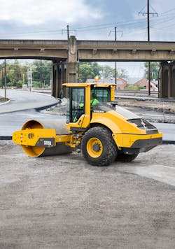
Next comes the fill necessary to meet the engineering design of the roadway with compactors prepping the surface to be load-bearing.
Trimble’s systems for soil compactors monitor pass count.
“The roller has gone over the area as many times as needed to achieve the appropriate stiffness or density of the material it's driving on,” says Garcia. “We can track whether it got total coverage onsite or if it missed some areas."
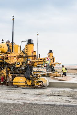
Trimble offers solutions for multiple machines in the concrete paving space, including placer/spreaders and mainline concrete pavers.
“The placer/spreader runs on a dual GNSS solution. We make sure that it always errs on the high side of the design so that we have more concrete than we need,” says Garcia, adding that the machine steers automatically, controlling elevation and slope.
“The operator would be responsible for starting and stopping and is tracking to make sure the concrete has got the appropriate moisture content and there is material to strike off in front of the machine,” Garcia adds. “The placer is then followed by the concrete paver that has a consistent head of material in front of it.”
The finish work happens the “old-fashioned way,” notes Garcia.
“You’ve got guys out there with trowels and floats finishing off the surface to make sure it's smooth,” he adds. “You’re oftentimes going to have a texture curing machine coming behind the paver to groove the pavement to help with water shedding and then spray on curing compounds to help that road set up quickly and with high strength. You pour the subsequent lanes or whatever you may need to finish out the job.”
Options to gather as-built data include using a drone, a mobile LIDAR scanner, a traditional topography approach, or having the system record where the pan is in relationship to the software’s targets.
“You could download the files off the machine and it would tell you exactly the surface that was laid down in the field,” says Garcia. “In the case of concrete, there’s going to be some very minor settling. But it would be very accurate in terms of having your as-built information of where that concrete is placed.”
Trimble has several ways of collecting the data and sharing it with the owner so that it can be placed into the asset database to know on a specific date that the road was paved at a certain thickness at a certain location to move into the own, operate, and maintain phase.


